Revolutionizing Mapping and Pioneering Physical AI
1
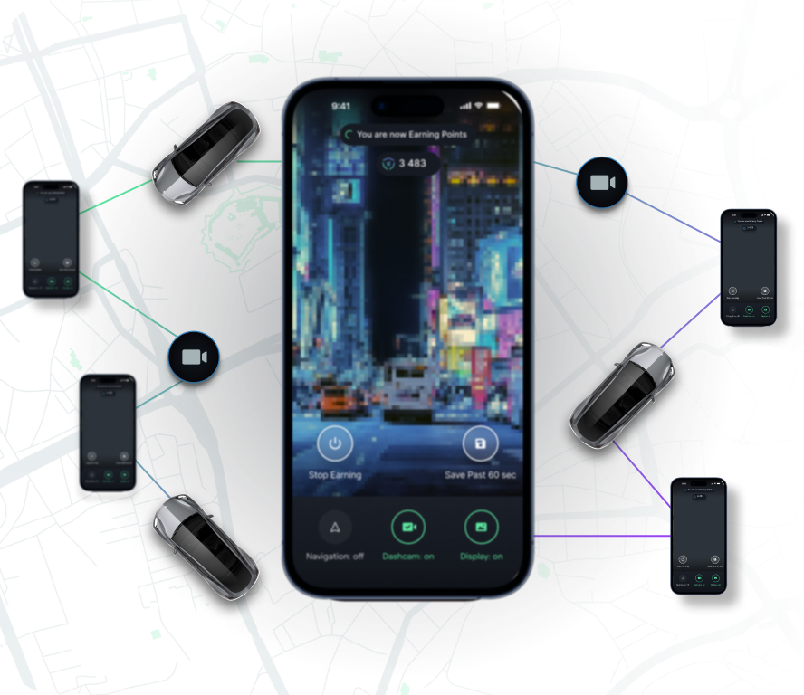
Global coverage and an ever-growing community
2
Cost-effective, highly scalable DePIN
3
Unique privacy compliant Computer Vision AI
%20(1).webp)
%20(1).webp)
Discover use cases:


World Foundational Models
WFMs are rapidly becoming the cornerstone of autonomous driving and broader robotics. WFMs can simulate millions of real-world scenarios for training, testing, and validation — dramatically accelerating Physical AI development and improving safety and reliability. NATIX captures synchronized 360° footage from vehicles around the world — representing the complexity of real-world motion in every direction.

3D Space Reconstruction
NATIX's 360 data from Tesla cameras can be used to reconstruct a three-dimensional representation of our world and lay the foundation for Physical AI — empowering autonomous vehicles, robots to understand and interact with their environments more intelligently.

Visual Positioning System
A Visual Positioning System (VPS) allows machines to determine their exact position using visual data, which offers an edge over existing technologies that are lacking in dense urban areas and indoors. Visual positioning solutions can determine the exact position of elements in relation to fixed landmarks and other moving objects.
World Foundational Models
WFMs are rapidly becoming the cornerstone of autonomous driving and broader robotics. WFMs can simulate millions of real-world scenarios for training, testing, and validation — dramatically accelerating Physical AI development and improving safety and reliability. NATIX captures synchronized 360° footage from vehicles around the world — representing the complexity of real-world motion in every direction.

Training Autonomous Driving Systems
As the first DePIN project directly contributing to the development of the autonomous driving stack, with the VX360, NATIX provides companies with 360° video data. This offers autonomous driving companies with affordable, and immediate access to the training and pre-training data for their systems and play a pivotal role in developing safer autonomous vehicles.

Scenario Generation
Scenario generation is a crucial process in the testing, verification, and validation of the autonomous driving stack. Using 360° video collected by VX360 users, NATIX can provide autonomous vehicle companies with classified real-life scenarios of edge cases for smarter, and safer autonomous driving models.

Privacy-Compliant Data
NATIX uses anonymization AI to automatically strip the captured imagery from personal identifiable information before they are contributed to the network. This ensures compliancy with data privacy regulations which is especially important in this day and age.

Fresh Street-level Imagery
Map makers can benefit from NATIX’s fresh street-level imagery, ensuring that the captured data reflects the latest changes in the environment. NATIX provides continuous data streams that enable map makers to maintain up-to-date visual information, improving accuracy and reliability of their maps.

Dynamic Map Attributes
NATIX’s data can provide map makers with up-to-date information on dynamic data, such as accidents, construction zones, faulty road infrastructure, and display real-time changes to traffic signs, providing accurate and timely information to drivers about speed limits, lane closures, and other traffic regulations.
Low-Cost Data Collection
NATIX leverages a crowdsourced camera network for data collection. By utilizing existing cameras in smartphones and Tesla vehicles, NATIX provides a cost-effective solution for collecting high-quality data without the need for expensive equipment or extensive setup.

Targeted (Laser focused) mapping
NATIX uses unique incentivization techniques to coordinate and mobilize its crowd-sourced network and offer targeted mapping capabilities. NATIX can provide map makers with street-level imagery data collected from specific areas, covering blind spots efficiently.

Event & Object Detection (on Edge)
Using Edge computing capabilities (on device), our computer vision AI pipeline can be used for real-time map attributes detection (e.g. traffic signs, potholes, road construction, and more), providing valuable insights and data for mapping applications.

Privacy-Compliant Data
NATIX uses anonymization AI to automatically strip the captured imagery from personal identifiable information before they are contributed to the network. This ensures compliancy with data privacy regulations which is especially important in this day and age.

Real-Time Infrastructure Inventory
Cities and road operators can revolutionize their infrastructure management by maintaining a comprehensive real-time inventory of critical elements such as traffic signs, traffic lights, and road conditions using NATIX data insights. This real-time inventory provides invaluable information for planning maintenance activities, optimizing traffic flow, and ensuring the safety of road users.

Road Infrastructure Damages
NATIX's comprehensive data capabilities facilitate continuous monitoring and detection of road damages such as potholes, cracks and faded road markings. Proactive monitoring of road conditions enables authorities to identify potential risks, prioritize maintenance tasks, and implement timely repairs or interventions.
.svg)

Why you should integrate NATIX with your product?
Use-Case Definition
We can help you with existing data or any specific data type you need. We can customize AI models that can detect the event of your interest to support your use-case.
Targeted data collection
We can target any region or location.If you have data gaps and blindspots in a certain region, NATIX can help you with targeted data collection for the desired use-case.
Seamless API integration
With our robust API we can connect with any platform for you to use the data seamlessly. You will the data in real-time fed to your system.
Historic Data Access
Gain access to historic data, whether it's historical pothole records or street-level imagery, through our comprehensive data API to support your analysis and decision-making processes.
.svg)


.svg)
